
Contract No. CP000789
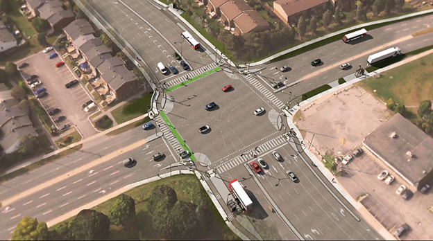
The intersection of Greenbank Road and Baseline Road has been reconstructed to allow for better public transit, pedestrian and cycling access. The project included dedicated bus priority lanes, new concrete sidewalks and curbs, asphalt cycle tracks, and reconfigured traffic lanes.
The underground work included the installation of new catch basins and the relocation/installation of utility structures.
Work at the Greenbank Road and Baseline Road intersection continued throughout the summer, with the majority of the work completed in September. Remaining work, including temporary pole removal and fence installation, is expected to be completed by the end of 2026.
To learn more about the project, visit the dedicated project webpage at Baseline/Greenbank transit priority intersection improvements↗.
Intersection operation update
The City’s Traffic Services team continues to monitor the intersection. Following a review of travel through the intersection, the following changes will be implemented to improve safety:
No right turn on red: Observations showed that vehicles turning right on red were blocking the crosswalks and bike crossings and moving too far into the intersection, creating conflicts with other road users.
Protected right turns for northbound and westbound traffic: Due to the significant right turn volumes in these directions, right turns will only be allowed when the dedicated right turn green arrow is displayed. This separates turning vehicles from pedestrians and cyclists.
These changes are anticipated to be implemented in early November.
Cycle track update
The cycle track is anticipated to open in November following the completion of the intersection signal updates. This work includes commissioning the cycle signals and removing the temporary barriers currently in place.
Work completed throughout the project
Underground infrastructure
Removal, relocation and installation of catch basins and leads
Relocation of Enbridge Gas services
Completion of Hydro Ottawa crossover
Installation of future electrical connections within north and south Greenbank Road medians
Traffic signals and electrical works
Installation of new traffic signals and streetlighting
Installation of new Hydro Ottawa poles and removal of existing poles
Installation of temporary streetlight fixtures and removal of existing poles
Signal controller upgrades
Installation of permanent streetlight fixtures at McWatters Road
Roadway improvements
Removal of Greenbank and Baseline medians and construction of new medians
Reconstruction of road-box reconstruction at all quadrants of the Baseline Road and Greenbank Road intersection
Paving operations throughout project limits
Pedestrian, cycling and transit improvements
Reconstruction of sidewalks and cycle tracks in the northeast and southeast quadrants
Installation of bus shelters at final locations on southeast and northwest corners
Installation of new traffic signals and streetlighting
Landscaping
Landscaping, including the planting of trees and shrubs within the southeast and northwest quadrant
Final works
The following work may still occur as part of the project:
Complete outstanding landscaping and restoration work
Traffic signal installation and commissioning
Line painting
Other associated finishing and commissioning activities
This means lanes may be temporarily reduced during off-peak hours to accommodate work as needed. Every effort will be made to avoid disruptions in the area as final work is carried out.
Protected intersections
The Baseline Road and Greenbank Road intersection was designed in accordance with the Protected Intersection Design Guide↗ for improved safety for drivers, cyclists, and pedestrians.
Protected intersections include features such as corner safety islands for pedestrians, forward stop bars to make pedestrians and cyclists more visible to motorists, and crossrides and crosswalks set back from the vehicle travel lanes.
Learn more about protected intersection design and safety features on the City of Ottawa's Protected Intersections↗ webpage.
Corner aprons
You may notice concrete extensions at the intersection corners, known as corner aprons.
The curved shape and textured surface of a corner apron encourages drivers to make slower, tighter right turns. Slower turning speed is intended to improve awareness of pedestrians and cyclists who may be crossing the intersection, and can help reduce the severity of a collision if one were to occur.
Passenger vehicles are intended to make tighter right turns on the asphalt portion of the roadway. Larger vehicles, such as transport trucks and buses, may use the corner apron safely to complete their turn when additional space is required.
To learn more about corner aprons and how they improve safety at protected inersections, watch this video: A closer look at corner aprons in protected intersections↗.
Photo 1: Completed bus lane and new cycle track (October 2026).
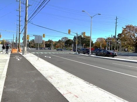
Photo 2: Crosswalk and crossride at southwest quadrant (October 2026).
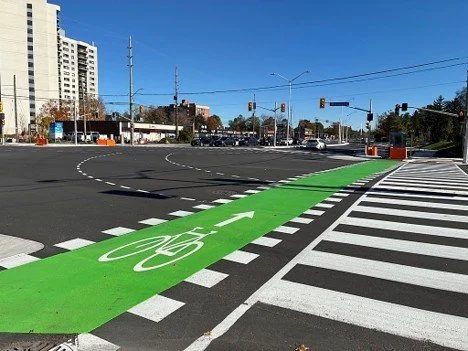
Photo 3: Protected intersection features (October 2026).
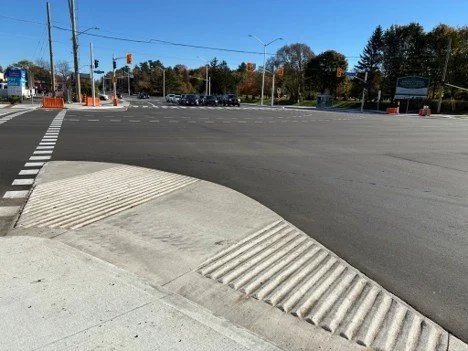
Photo 4: New corner apron for safety (October 2026).
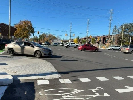
Accessibility
Accessibility is an important consideration for the City of Ottawa. The City makes every effort to provide access through and around construction sites If you require a disability-related accommodation, please contact the project team listed below. Accessible formats↗ and communication supports are available, upon request.
Mobility and you
Stay informed about capital construction↗. Check out the City’s traffic map↗ and incident report↗ or call 3-1-1 for updates about when and where construction is happening.
Contact us
Visit us on the web↗.
Have questions? Contact the project team through email↗.